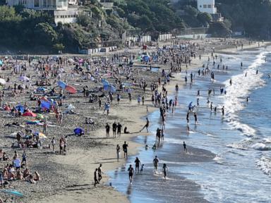
California Heat Wave Shatters Records, Over 35 Million Under Alerts
A relentless October heat wave grips California, breaking records with temperatures 20 degrees above normal, impacting over 35 million people.
A powerful and dangerous October heat wave is continuing to bake California, with over 35 million residents currently under heat alerts as temperatures soar significantly above seasonal averages. The multi-day event is expected to persist, pushing temperatures as high as 20 degrees Fahrenheit above normal for early October across nearly the entire state.
The extreme heat is impacting a vast area, stretching from Northern California, including the San Francisco Bay Area, down to the Mexico border. Many regions are experiencing highs in the 90s and 100s, with little relief anticipated during warm nights, particularly in urban centers. Los Angeles and San Diego are under an extreme heat warning, while San Francisco and Sacramento have heat advisories in effect.
Sunday afternoon saw temperatures reaching the high 90s across much of the state, with some areas exceeding 100 degrees. Forecasts indicated highs near 104 degrees in downtown Los Angeles and 103 in Bakersfield, with San Diego and Sacramento also experiencing temperatures well into the 90s. The extreme heat warnings for Southern California are scheduled to remain active until Thursday evening, signaling a prolonged period of dangerous conditions.
The heat is not confined to California, with the West expected to experience above-average temperatures over the next 24 hours. Areas as far north as southern Idaho and Montana could see highs in the upper 80s on Monday, potentially challenging daily record highs in cities like Boise and Billings. Denver is also forecast to reach the upper 80s on Monday.
Record-breaking temperatures were already observed on Saturday. At least eight Southern California cities surpassed their daily high-temperature records, including Anaheim and San Diego, which both hit 105 degrees, and Santa Ana, reaching 107 degrees. Vista, located north of San Diego, recorded a high of 108 degrees, not only breaking its daily record but also tying an all-time record high set in June 1985.
Meanwhile, a starkly different weather pattern is affecting the Gulf Coast and Southeast regions, where flood watches are in effect. Areas from southeastern Louisiana to southern Georgia, including major cities like New Orleans and Tallahassee, are under these alerts due to expected heavy rainfall.
Residents in these southeastern states face a level 2 of 4 risk for excessive rainfall and flash flooding through Monday. This risk extends from southeastern Louisiana through the Florida panhandle and up into South Carolina. Torrential rain is also anticipated in parts of South Texas on Sunday afternoon and evening, potentially leading to significant flash flooding.
The concurrent extreme heat in the West and heavy rainfall in the Southeast highlight a pattern of severe weather impacting different parts of the country simultaneously. Officials are urging residents in affected areas to stay informed about weather alerts and take necessary precautions for both extreme heat and potential flooding.
This article was written by AI based on publicly available news reporting. Original reporting by the linked source.