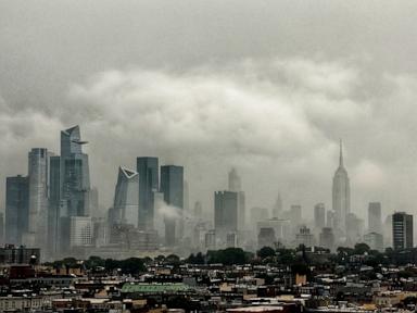
Northeast Faces Level 3 Flood Risk Tuesday; D.C., Philly, NYC in Path
The Northeast and Mid-Atlantic face a severe storm threat Tuesday, with a Level 3 flash flooding risk impacting major cities.
The Northeast and Mid-Atlantic regions are preparing for significant severe weather and potential flash flooding on Tuesday, following heavy rainfall over the weekend. The most critical threat, rated a Level 3 out of 5, is forecast to impact an area stretching from northeastern Kentucky to New Jersey. This zone includes major metropolitan areas such as Pittsburgh, Washington, D.C., Baltimore, and Philadelphia.
This renewed severe weather outlook follows a weekend where parts of the region were already deluged with heavy rain. The forecast indicates the possibility of numerous severe thunderstorms capable of producing destructive winds and even tornadoes within the Level 3 risk area. The threat of flash flooding is particularly concerning along the busy Interstate 95 corridor, affecting travel and daily life in densely populated cities from Washington, D.C., through Philadelphia and up to New York City.
Flood watches have been issued for Tuesday, covering a wide area from Delaware to southern New York. Meteorologists are concerned about slow-moving thunderstorms that could bring torrential rainfall, with rates potentially exceeding one inch per hour. These intense downpours raise the likelihood of flash flooding, especially in urban environments where drainage systems can be overwhelmed.
The storms are expected to develop by late morning or early afternoon and persist throughout the day. The combination of heavy rain and potential urban flooding poses a significant challenge for residents and emergency services in the affected cities. Officials are urging caution and preparedness for rapidly changing weather conditions.
The meteorological analysis suggests that the atmospheric setup is conducive to the development of organized severe thunderstorms. Forecasters are closely monitoring the progression of these systems, emphasizing the risk of rapid inundation in low-lying and urbanized areas. The potential for rainfall rates of over an inch per hour means that even short periods of intense rain could lead to dangerous flash flooding.
Residents in the forecast path are advised to stay informed about weather updates and to have a plan in place in case of severe weather or flooding. This includes knowing evacuation routes if necessary and securing property against potential wind damage. The National Weather Service has highlighted the importance of heeding all warnings and advisories issued by local authorities.
The forecast also mentions the possibility of tornadoes, adding another layer of danger to the anticipated severe weather. The combination of destructive winds, heavy rain, and potential twisters creates a complex and hazardous weather scenario for millions of people across several densely populated states.
As the region braces for Tuesday's weather, attention will be focused on the speed and intensity of the storm systems, as well as the effectiveness of public warnings and emergency responses. The events of the coming day will be closely watched by weather experts and the public alike, given the significant disruption and danger posed by severe thunderstorms and flash flooding.
This article was written by AI based on publicly available news reporting. Original reporting by the linked source.